

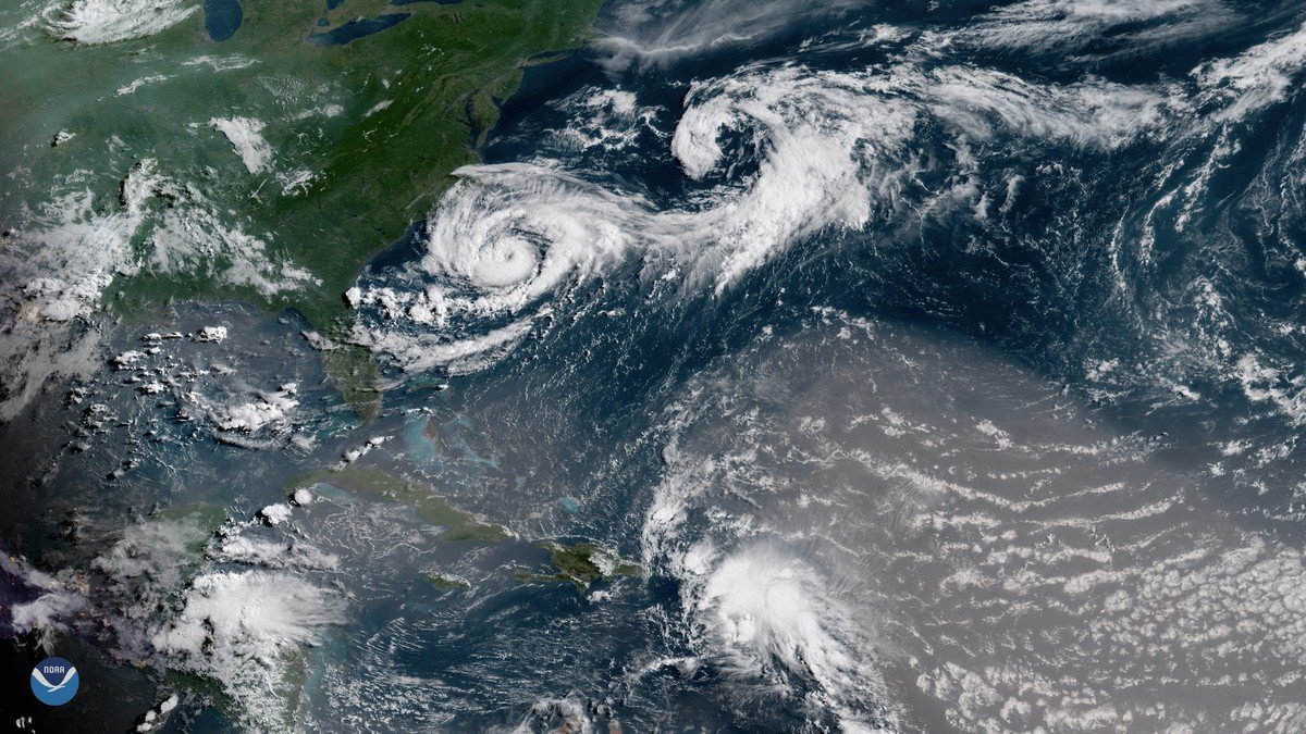
The National Hurricane Center (NHC) officially designated Tropical Storm Helene on September 24, 2026, in the northwestern Caribbean Sea, triggering immediate hurricane and storm surge watches along a vast stretch of the Florida Gulf Coast. Moving northwestward with steadily accelerating forward speed, the sprawling cyclone is projected to cross the Yucatan Channel into the Gulf of Mexico, where environmental conditions are dangerously conducive to rapid explosive strengthening before a projected Thursday landfall.
Meteorologists track Helene's center as it churns through open water, noting that the storm already features an unusually large wind field extending several hundred miles from its core. As the system navigates past the western tip of Cuba, it is steered by an expansive upper-level ridge to the east and a trough over the central United States, creating an atmospheric conveyor belt that will propel the storm directly toward the Florida Big Bend and Panhandle coastlines at an accelerated pace.
Meteorological Trajectory and the Threat of Rapid Intensification
Of paramount concern to atmospheric scientists is the extraordinary thermal energy stored in the eastern Gulf of Mexico. Sea surface temperatures along Helene's path are hovering between 30 and 31 degrees Celsius (86 to 88 degrees Fahrenheit)—temperatures far above the climatological average—accompanied by deep oceanic heat content and light vertical wind shear. The NHC emphasized that these conditions provide near-ideal fuel for rapid intensification, projecting Helene to escalate into a Category 3 or greater major hurricane with sustained winds exceeding 115 miles per hour.
In response to the deteriorating forecast, Florida Governor Ron DeSantis expanded an executive state of emergency to cover 61 of the state's 67 counties, mobilizing hundreds of Florida National Guard soldiers and prepositioning high-water search-and-rescue teams. Municipalities and school districts across northern and central Florida announced campus closures, while state emergency managers coordinated fuel reserves and staged heavy utility restoration trucks along major interstate corridors.
“Helene has the potential to rapidly intensify into an extremely dangerous hurricane before making landfall along the Florida Gulf Coast. Residents must finalize their storm preparations immediately.”
Florida Emergency Mobilization, Evacuations, and Regional Impact
Emergency management officials in counties including Pinellas, Hillsborough, Citrus, Taylor, and Franklin issued mandatory evacuation orders for residents on barrier islands, in manufactured homes, and within low-lying coastal flood zones. Forecasters issued stark warnings that Helene could unleash a catastrophic storm surge of 10 to 15 feet in the Apalachee Bay region, capable of submerging coastal roads, severing escape routes, and destroying shoreline infrastructure well before the eye reaches shore.
The danger is not confined to the coast. Because Helene is an exceptionally large and fast-moving system, hurricane-force gusts, torrential rainfall, and tornado risks will penetrate deep inland across southern and central Georgia, the Carolinas, and the southern Appalachian Mountains. Emergency agencies throughout the southeastern United States are warning residents hundreds of miles from the coastline to prepare for widespread power outages, downed timber, and flash flooding through the weekend.

Comments (0)
Log in to join the discussion.